geoweb.hft-stuttgart.de
Supporting the world-wide geodata and geo-services network
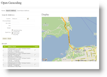
OpenGeocoding
“A lot of spatial data is locked up and won’t see the light of day unless major policy changes occur. While there would appear to be some legitimate concerns for some of this data to remain inaccessible, the question really is more about the benefits that we’re missing than the benefits we gain by keeping it locked away.” — Matt Ball, editor, the Americas and Asia/Pacific
Objectives
The aim of this service is to offer worldwide addressing and geocoding based on a participatory approach.
Every day, postal addresses are used as a common means to provide citizens, business entities and public administrations with a simple and clear description of locations.
OpenGeocoding.org is a concept and a website developed by one of the alumni of our University, Astrit Rimayanti, in 2007. This project aims to collect geocoded address data, e. g. postal addresses and coordinates, in order to make them available and usable by web based services on a worldwide level with a focus on developing countries.
While in developed countries usually governmental or private nation-wide efforts generate and maintain address data, in less developed countries such geodata are still not available. The main objective of this project is the availability of a worldwide free address database for developed and developing countries.
The application aims to collect data as well to provide a geocoding service.
- Data collection: Registered users submit address information and corresponding coordinates. Special attention is given to the validation to prevent spamming, by comparison of entered data to existing reference data on country, province and city level. Supported by AJAX based techniques (Garret 2005) for map display and user friendly auto-completion, users can enter addresses and the corresponding coordinates which could be derived from maps or GPS measurements. Alternatively, users can use a Web map (currently also Google Maps) to digitize the location. After successful data validation, address and coordinates are saved in the database and can be used for geocoding, interactively or through the API.
- Geocoding: The geocoding service for postal addresses is offered based on this data free of charge through a REST based web service. The geocoding application does not rely only to its internal database filled by the community. If no relevant results can be retrieved, the request will be forwarded to other publicly available geocoding services. The result will be checked, parsed, and forwarded to the user in a specified format.
Your support – Getting involved
To achieve this goal and for the mutual benefit for the societies in each of your countries we would like to ask for your support in several ways.
- If you are the owner or custodian of address data we would like to invite you to provide your data at the disposal of a worldwide community.
- In addition we invite you to promote this project and publicize the benefits that all of us can derive from it, to your colleagues, partners, and friends and invite them to share their data as well.
- And, at a minimum, you can use the OpenGeocoding website, to digitize your location and other locations you know.
- Tell your Twitter followers: Interesting and useful service: http://opengeocoding.org
The geocoded information provided is made available through the website by a digital user interface as well by web services in different formats. This interoperable service can be integrated into your application and business processes as well as through the web.
The data will be protected by a licence similar to OpenStreetMap (http://creativecommons.org/licenses/by-sa/2.0/).
We encourage you to join our community and we hope we could together realize our idea of a data repository and service useful for each participant and for the society.
Feel free to contact us if you have any question or suggestion.
References
Franz-Josef Behr (2010): Geocoding: Fundamentals, Techniques, Commercial and Open Services. in: Franz-Josef Behr, Anakkathil Purushothaman Pradeepkumar, César A. Beltrán Castañón (2010): Proceedings Applied Geoinformatics for Society and Environment (AGSE 2010). Publications of the Stuttgart University of Applied Sciences, Hochschule für Technik Stuttgart, Volume 109 (2010), 206 pp., ISBN 978-3-940670-19-9
Franz-Josef Behr, Astrit Rimayanti (2008): OPENGEOCODING.ORG – A free, participatory, community oriented Geocoding Service. ISPRS 2008, Commission IV, WG IV/5, The International Archives of the Photogrammetry, Remote Sensing and Spatial Information Sciences. Vol. XXXVII. Part B4. Beijing 2008 [pdf]
Claudia Schwegmann (2010): Where are these projects? Geocoding is possible! http://www.openaid.de/news/where-are-these-projects-geocoding-possible
Register
Geocode
Download
API
Statistics