geoweb.hft-stuttgart.de
Supporting the world-wide geodata and geo-services network
OpenDTM
Objectives
A Digital Terrain Model (DTM) is a often raster oriented representation of elevation values representing the world as a regular arrangement of pixels (cells).
The aim of this site is to make data products availabel based on freely available DTM data, e.g., data of NASA’s Shuttle Radar Topography Mission (SRTM).
Currently we offer a WMS for Contour Lines and the download of Contour lines in XML based OSM format.
WMS for Contour Lines
- WMS GetCapabilities Request (beta)
- Sample WSM request
- Sample Map with Countour Lines
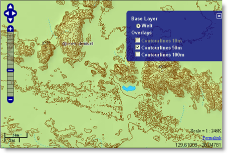
The WMS can be embedded in a OpenLayers client as follows: // Erstellen der Ebenen var basic = new OpenLayers.Layer.WMS(“Welt”, “http://www2.demis.nl/mapserver/wms.asp?”, {layers: ‘Bathymetry,Countries,Topography,Hillshading,Builtup areas,Cities,Rivers,Waterbodies, Inundated,Streams,Railroads,Highways,Highways,Trails,Borders,Settlements,Spot elevations, Airports,Ocean features’, format: ‘image/jpeg’}, {buffer: 0}); var hl10 = new OpenLayers.Layer.WMS(“Contourlines 10m”, “http://geoweb.hft-stuttgart.de/cgi-bin/mapserv?map=/home/fjbehr/SRTM/test.map”, {layers: ‘Contourlinien10’, format: ‘image/jpeg’, transparent: ‘true’}, {buffer: 0, visibility: false, minScale: 0.00001}); var hl50 = new OpenLayers.Layer.WMS(“Contourlines 50m”, “http://geoweb.hft-stuttgart.de/cgi-bin/mapserv?map=/home/fjbehr/SRTM/test.map”, {layers: ‘Contourlinien50’, format: ‘image/jpeg’, transparent: ‘true’}, {buffer: 0, visibility: false, minScale: 0.000001}); var hl100 = new OpenLayers.Layer.WMS(“Contourlines 100m”, “http://geoweb.hft-stuttgart.de/cgi-bin/mapserv?map=/home/fjbehr/SRTM/test.map”, {layers: ‘Contourlinien100’, format: ‘image/jpeg’, transparent: ‘true’}, {buffer: 0, visibility: false, minScale: 0.0000005}); // Hinzufugen der Layer zu der Karte map.addLayers([basic, hl10, hl50, hl100]);
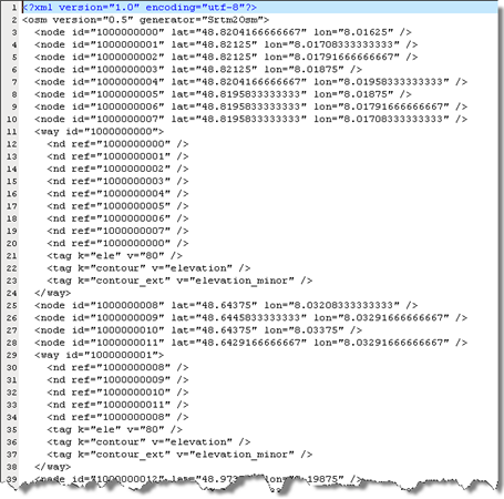
Contour lines in OSM format (XML)
In addition, SRTM Data can be downloaded as contour lines in OSM format, provided by Christoph Eckert (61GByte totally). An example and some background information can be found here.
The data are tiled and zipped. The file name format is like Lat48Lon8Lat49Lon9.osm.zip and can be downloaded from http://geoweb.hft-stuttgart.de/SRTM/srtm_as_osm/.