geoweb.hft-stuttgart.de
Supporting the world-wide geodata and geo-services network
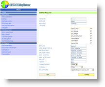
SUAS MapServer
The Web Map Server Implementation Specification (WMS), originally developed and published by the Open Geospatial Consortium, was finally adopted by ISO as an international standard.
SUAS MapServer supports this specification and a few other services like 3D representation. Geo-data is converted to Well-known Text (WKT) and stored in database management system, retrieved by SUAS upon user request and transferred – optionally compressed – through the Internet for client-side visualization.
Literature
H. Li and F.-J. Behr (2009): SUAS Mapserver – An Open Source Framework for Extended Web Map and Community Services. in: Franz-Josef Behr, Dietrich Schröder, Pradeepkumar A. P. Editors, 2009): Proceedings Applied Geoinformatics for Society and Environment (AGSE 2009). Publications of the Stuttgart University of Applied Sciences, Hochschule für Technik Stuttgart, Volume 103 (2009), 317 pp., ISBN 978-3-940670-13-7
F.-J. Behr, Li H. (2008): SUAS MapServer – an Open Source Framework for extended Web Map Services. ISPRS 2008, Commission IV, WG IV/5, The International Archives of the Photogrammetry, Remote Sensing and Spatial Information Sciences. Vol. XXXVII. Part B4. Beijing 2008